NEW MEXICO > Gila Resources
MAPS
AllTrails App, Google search
National Forest Gila Map - Cliff Dwelling gift shop
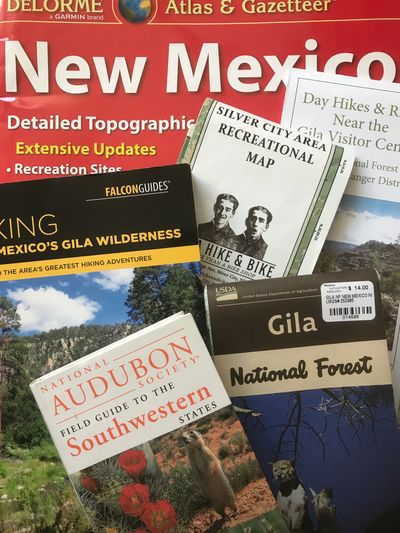
Day Hikes & Rides Near the Gila Visitor Center, $2 at the gift shop
Gila Hike & Bike Shop’s Silver City Area Recreational Map
DeLorme’s New Mexico
Forest Service has a free pocket guide at the Ranger Stations. It is available online at https://www.fs.usda.gov/Internet/FSE_DOCUMENTS/fseprd590633.pdf
For a complete reference to the Gila, see the very large Gila National Forest map from the U.S. Forest Service, Southwestern Region. This lived on our living room floor.
BOOKS
Falcon Guide, Hiking New Mexico’s Gila Wilderness, 2018, Bill and Polly Cunningham
A Sand County Almanac, Aldo Leopold
Audubon Field Guide to the Southwestern States
Current Trail Conditions www.gilatrailsinfo.org
US Forest Service Trail Maintenance Log
https://www.fs.usda.gov/Internet/FSE_DOCUMENTS/fseprd902222.pdf
ROCKS
https://www.casitasdegila.com/rockhounding.html
TRAIL DESCRIPTIONS
USDA Forest Services https://www.fs.usda.gov/main/gila/home
southernnewmexicoexplorer.blogspot.com
travelsofthermercury.blogspot.com
CONTINENTAL DIVIDE NATIONAL SCENIC TRAIL, CDNST #74
We hiked about 30+ miles of the CDT with in/out day hikes, via the non-4x4 CDT access trailheads in the south half of the Gila - Silver City, the Burros, Pinos Altos and the Mimbres areas. See each Regions trails noted as CDNST #74.
CDT New Mexico
https://continentaldividetrail.org/explore-by-state/new-mexico/
CDT Closures
https://continentaldividetrail.org/about-the-trail/cdt-fire-incidents-and-information/
Article
https://www.newmexico.org/nmmagazine/articles/post/along-the-great-divide-84070/